
Backpack To Jordan Hot Springs, Gila Wilderness, NM
Disclosure: This post contains Amazon affiliate links. As an Amazon Associate we earn a small commission at no additional cost to you. Please read our disclaimer.
We met Em and Micah in one of the Great Sand Dunes National Monument parking lots. Like us, they had also just backpacked out of the dunes after spending the night. We chatted for a while; they’re both traveling nurses who live in their van when they’re not on a job. A week or so after meeting them, Em sent me a text about Jordan Hot Springs. They had just come back from there and thought we’d really enjoy it – and dogs are allowed on the trails!
I googled Jordan Hot Springs and found a bunch of information on the hike. Turns out it’s a really popular hot spring (and it can get crazy busy over weekends and spring break – avoid spring break like the plague). Jordan Hot Springs is located in Gila Wilderness in the southwestern part of the state (the nearest town is Silver City). The trailhead for Jordan Hot Springs is about a mile from Gila Cliff Dwellings National Monument. Since it’s a far drive out to both places, I’d recommend maximizing your trip by visiting the national monument (if you haven’t already) and backpacking out to the hot spring. Obviously, Gila National Forest offers a whole bunch of additional trails that can be explored.
Though I had already learned a bunch online, we also stopped at the Gila Interagency Visitor Center to get additional information (it’s about two miles from the national monument). I like talking to rangers who can sometimes provide more up-to-date info and useful personal insight. Also, I like talking to them specifically about the route. This map (photo below) was displayed on a bulletin board outside the visitor center of the numerous hikes available near the visitor center.

As you can see on the map, there are a few different ways to backpack to Jordan Hot Springs (the most northern tip on the map). Jerud and I opted for hike #5 on the way in and hike #3 on the way out.
Hike #5 is known as “Little Bear Canyon to Jordan Hot Springs”. We chose this route because the trailhead (TJ Corral) was a mile from where we had parked the Toaster (at the Gila Cliff Dwelling National Monument parking lot). Side note: There are two campgrounds for tent camping: Lower and Upper Scorpion Campground. Smaller rigs can fit in the parking area. The ranger at the visitor center had told us that we could stay overnight in any of the parking lots. We had chosen the parking lot for Gila Cliff Dwelling because it was a lot larger. This worked out because we were there during mid-week and it wasn’t busy. Please be considerate of other visitors if you plan to park in one of the parking lots.
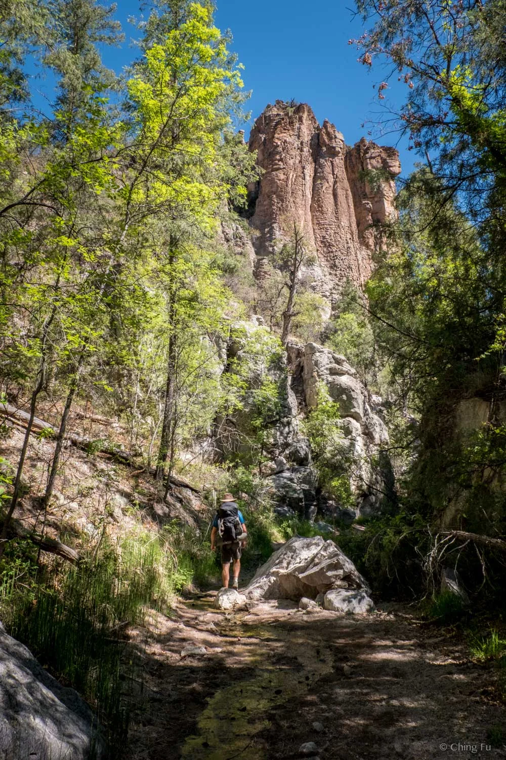
It’s a 7-mile hike from TJ Corral trailhead to the spring with about 630 feet of elevation gain. It’s not a difficult hike at all and you get to walk through Little Bear Canyon which is really cool. Depending on what time of year you go, the water level in the canyon will vary. There was just a trickle running through the canyon when we went. We didn’t even get our feet wet. But that doesn’t last long. Where Little Bear Canyon intersects with the Middle Fork of Gila River is the start of the river crossings – about 15 of them. From this intersection you’ll follow the Gila River upstream for about 2.5 miles (for some reason it felt like a long 2.5 miles on the way in). You’ll know when you’re close to the hot spring because you’ll cross the Gila River and it’ll feel warm near a stream that’s flowing into the river. Follow that warm stream and it’ll lead you to the hot spring (a steep short hike up in the woods on the northeast, side of the canyon).
Hiking through Little Bear Canyon. You can see the tiny stream in the middle of the trail.

Jerud and Tyki hiking the first section of trail from TJ Corral.

Little Bear Canyon

The view of Gila River Canyon after at the West Fork of the Gila River is spectacular!

Rock formations in Gila River Canyon.

The start of the river crossings. Most were only ankle deep when we were there.
There are numerous campsites starting at the intersection of Little Bear Canyon and Gila River all the way to the hot spring (and past it). We lucked out big time because it wasn’t crowded at all when we arrived. There were two people already there, but they soon disappeared after an hour or so. Two other people showed up but also left after 30 minutes. We ended up having the hot spring to ourselves the remainder of the time we were there. That also meant the two campsites right above the hot spring were available, which is where we ended up staying. I wouldn’t recommend staying at those campsites at all during busy times. You’ll never get any privacy being that close to the springs and the sites themselves aren’t great (not particularly flat or large). Camping here also means having to hike a bit to find a place to dig a cat hole. Leave No Trace tip: Do not pee/poop in this camping area. It’s so heavily used by people and close to the hot spring. Remember, you should pee/poop at least 200 ft. away from a water source (this includes the river, and the hot spring), and pack out your toilet paper. It’s actually really hard to find a good area that’s far enough from water and campsites to dig a cat hole. We had to cross the river and go into the woods to find an appropriate spot. Honestly, now that I’ve been there, I think it’s smarter to bring your own poop bag and carry your waste back out with you because of the amount of traffic the spring receives and lack of appropriate places for bathroom use. I wouldn’t be surprised if the forest service makes poop bags mandatory in the future.

Hanging out at camp.
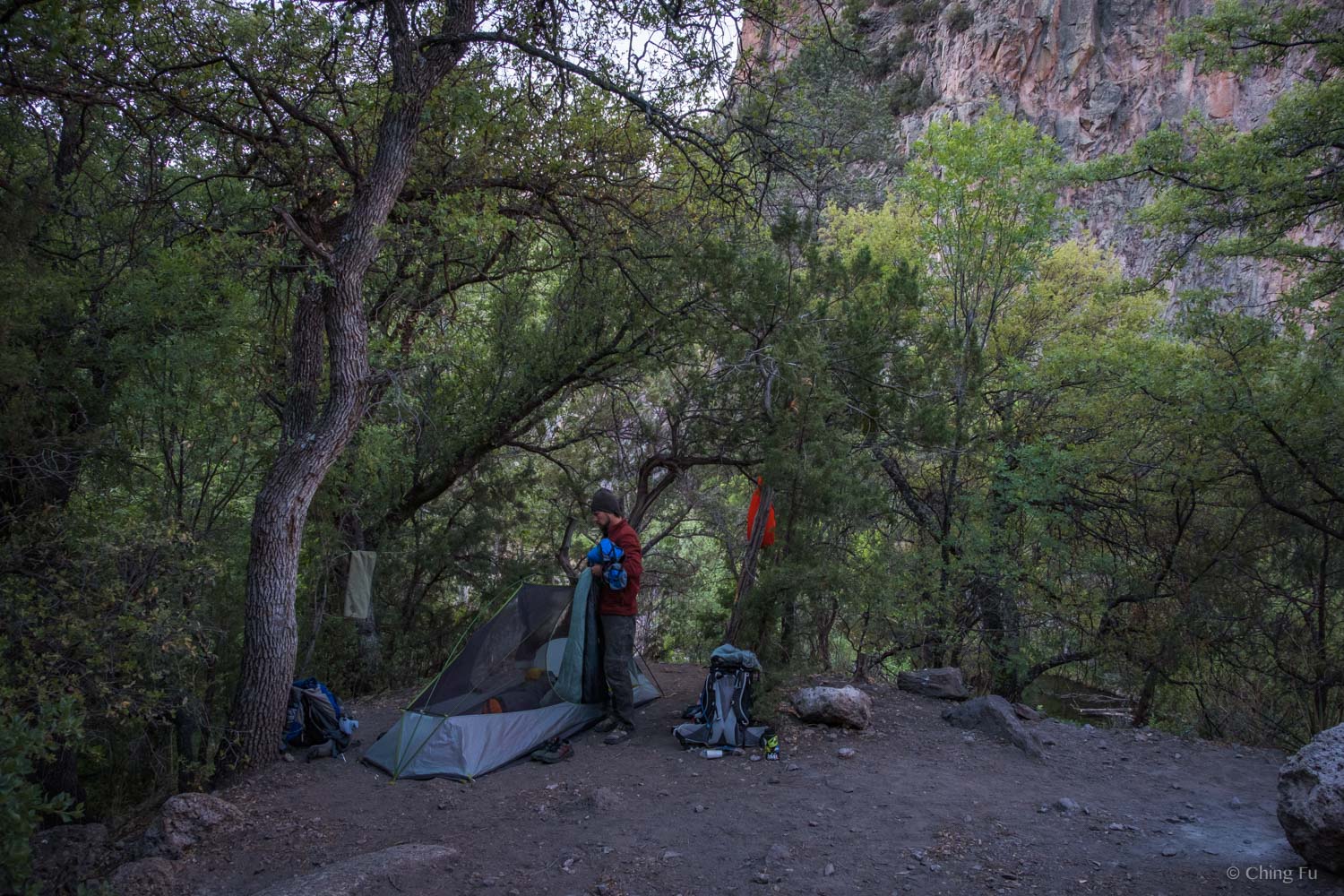
Breaking camp the next morning.

SIDE STORY
About the two people who were already at the hot spring when we arrived – we never talked to them besides a “hi”. But two days later when we were leaving the area, after making a side trip to paddle Lake Roberts, we saw two hitchhikers on the side of Hwy 152. Since there are a lot of Continental Divide Trail thru-hikers in this area, we had been making a point to pick hitch-hikers up. So, we found a spot to turn the Toaster around and approached them. Turned out it was the same two people from the hot spring!
We learned that Raven and Freebird (their trail names) are perpetual hikers. They’ve thru-hiked the Appalachian Trail (AT), Continental Divide Trail (CDT), Pacific Crest Trail (PCT), and other lesser-known trails over the last several years. Everything they own is in their backpacks and they are passionate about their nomadic lifestyle. And (I found this super cool), they lived in a cave for several months in Moab, UT (it was like a small community that lived in this cave).
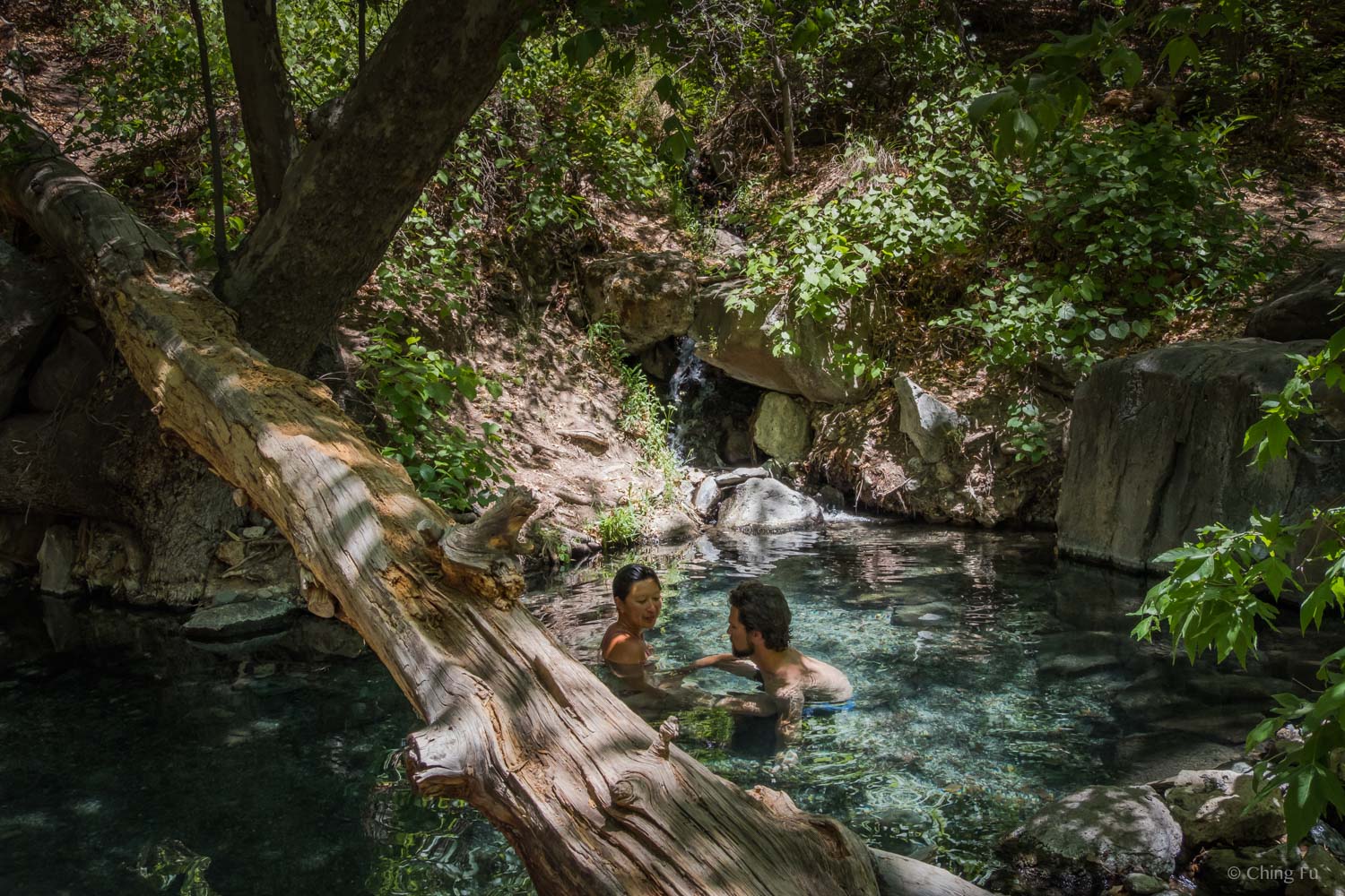
Jordan Hot Spring was the first hot spring we’ve ever backpacked to and it was beautiful! It’s tucked under a canopy of trees. The water is crystal clear and the bottom is covered in small pebbles. Unlike some hot springs, moving around doesn’t churn up any gunk. The downside is that the spring isn’t steaming hot (some say it’s around 90 degrees). Also, there are warnings that the springs contain bacteria that may cause meningitis if it comes in contact with your mucus membranes. This means - don’t put your head in the water.


We only stayed one night. In the morning we decided to hike out another way since we wanted to see more of the area. We opted to take the West Fork Loop (hike #3 on the map), which would add about 10 additional miles. To get to where West Fork Loop and Little Bear Canyon intersects meant hiking out ¾ of the way we came in. But the hike would end right in the Gila Cliff Dwelling parking lot where the Toaster was parked.
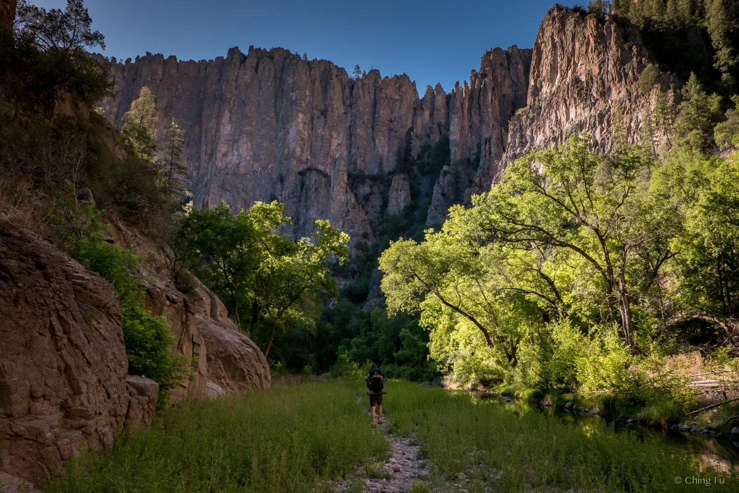
Backpacking out of Gila River Canyon the next morning.
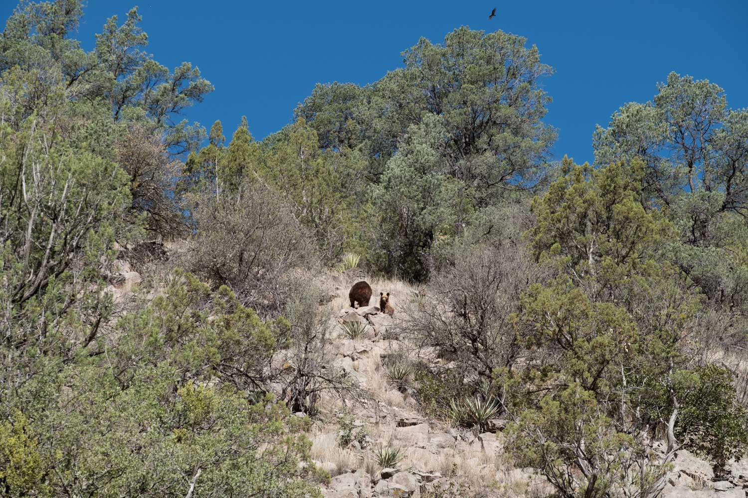
We saw a mama black bear and her two cubs while backpacking out.
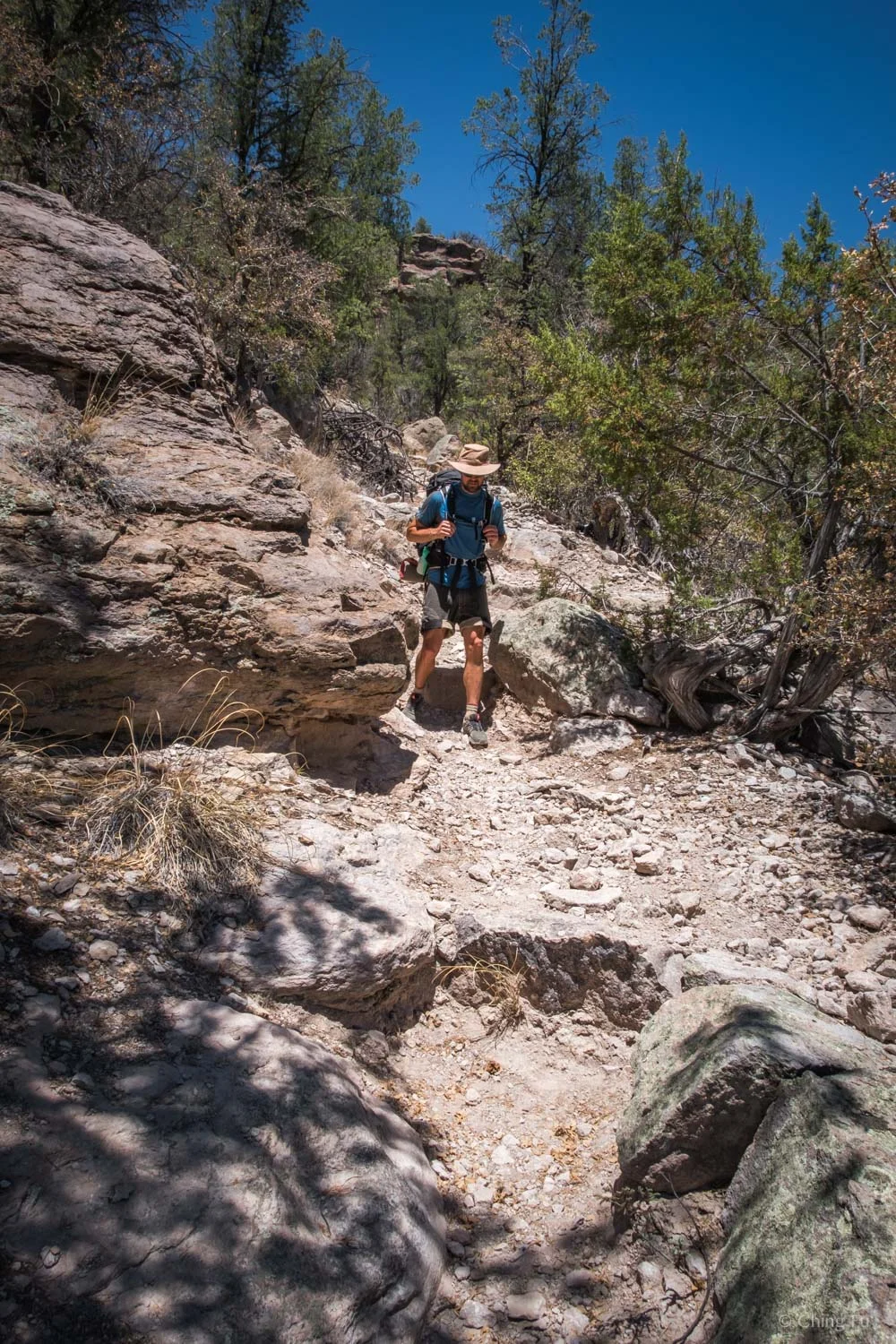
I hate to say it, but that route ended up not being worth it. The views at the ridge were good, but the rest of the hike didn’t have much of one. Also, be prepared for about a 4 mile straight up section and then a 3 mile straight down section. That was tiring, but not horrible. The worst was the last two miles where we had a hard time finding the trail (unlike the rest of this trip), and hiked in sand and full sun.
The last 3-mile downhill section of the West Fork Loop.

Lunch time in the only shade we could find that was free of cacti along the West Fork Loop.

Ugh, this section of the trail was miserable.
In hindsight, we should’ve done the Little Bear Canyon/Middle Fork Loop (hike #5 and #6 on the map). That would’ve been a 11-mile loop, including a 2 mile road walk back to the Toaster. But I’ve heard that the Middle Fork section of the Gila River is stunning. Lots of river crossings in that section too. I can’t remember why we didn’t choose that route.
Overall our backpack trip to Jordan Hot Spring was superb! Have fun, follow Leave No Trace principles and best of luck finding the least busy time to go!
Leave No Trace principles
Plan ahead and prepare
Travel and camp on durable surfaces
Dispose of waste properly
Leave what you find
Minimize campfire impact (be careful with fire)
Respect wildlife
Be considerate of other visitors
TIPs
I actually wouldn’t recommend wearing Chaco or Keen sandals for the river crossings. The trails are really sandy in that section of the hike. That’s what we did on the way in and both our feet were miserable. The mixture of wet feet and sand screams “blister” and “hot spots”! On the way out, we both kept our Salomon trail runners (Jerud’s / mine) on. Wear wool socks (wool will keep your wet feet feeling warmer than other material) and then rinse out your shoes and socks after the last river crossing. Or bring an extra pair of socks to change into.
Remember to wash your cookware and dishes away from water sources. Collect water and wash your cookware at least 300 feet away from water. Pack out the leftover food bits that don’t get eaten or bury it.
The elevation here is around 6,000 feet. Bring extra layers because the nights can get chilly.
We were here May 16 - 17, 2018.

