Straight Up Hiking In Carcross, Yukon
Yukon’s motto is “Larger Than Life”, which until writing this post had confused me. It turns out the reason why it’s perplexed both Jerud and me is because the phrase seems to be used incorrectly. Apple’s dictionary for “larger than life”: seeming disproportionately important, interesting, etc.; attracting much attention. To me, “larger than life” kind of has a negative connotation. I can guess what Yukon Tourism is trying to convey with their motto, but I think “Wilder Than Life” is more appropriate.
Yukon has a population of 36,304 and an area of 186,661 sq. miles. Those numbers alone convey how large it is in land size but sparse in population. Out of the 36,304 people who live in Yukon, 26,418 of them reside in Whitehorse (the capital and only “city”) with an area of 160 sq. miles. That leaves the rest of the province pretty much unpopulated, which is obvious when traveling through the area. Yukon is densely covered in trees, lakes, rivers, and mountains. There are twice as many moose in Yukon as there are people. (We’ve so far seen 1 of the estimated 70,000 moose.) The majority of the land here is untouched. It’s a nature-lover’s paradise and where hermits move to (seriously).

A lot of untouched land in Yukon.
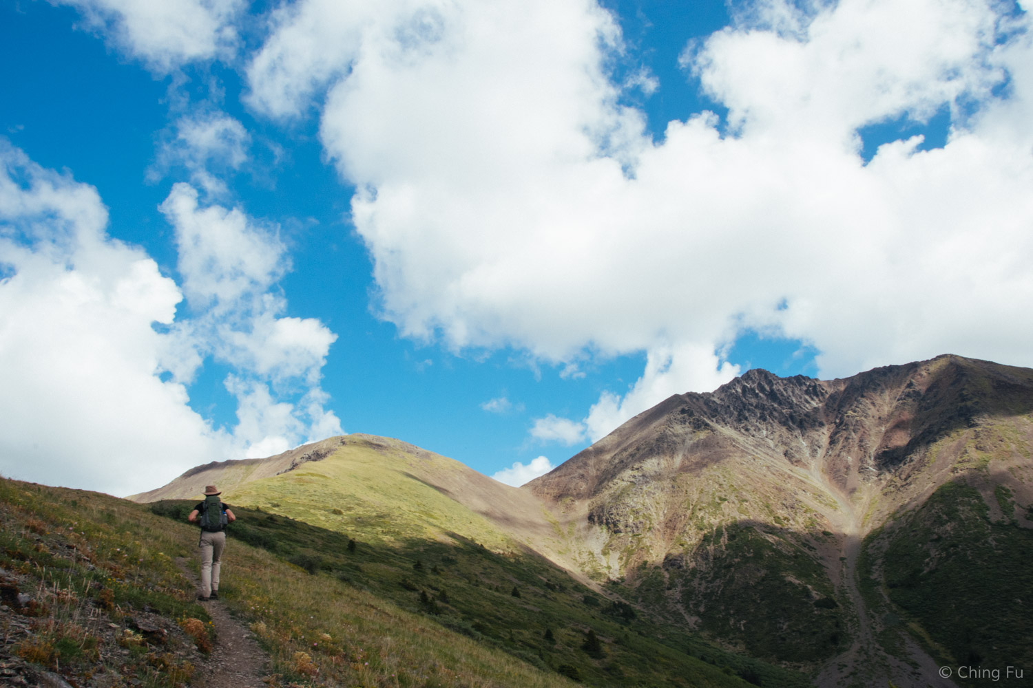
When I keep all that in mind, it makes more sense why a lot of their hiking “trails” (that we’ve been on) go straight up the mountain. With so much land, it’s just not possible to have maintained, purposely laid out trails everywhere. The lack of trails doesn’t stop the locals from hiking, though. If anything, it’s more enticing because they get to truly explore. Nearly every mountain is open to being hiked if it catches someone’s attention. If previous hikers have already worn a footpath then it’s continued to be used. If there isn’t a footpath then hikers find their own route. Perhaps they share their route with friends and over time enough people go up the mountain the same way to create a “trail”. Either way, from our experience so far, scrambling is required at some point during the hike. And we've gotten our butts kicked by the trails! I'd recommend including a lot of squats and one legged lunges to your daily workout before you head to Yukon to hike.
Caribou Mountain
Yukon Hiking, where I’ve gotten all my hiking information, describes the hike up Caribou Mountain as “steep and to the point” and that pretty much sums it up.

Google Earth view of our hike from Yukon Hiking.

This guy marks the trailhead for Caribou Mountain.
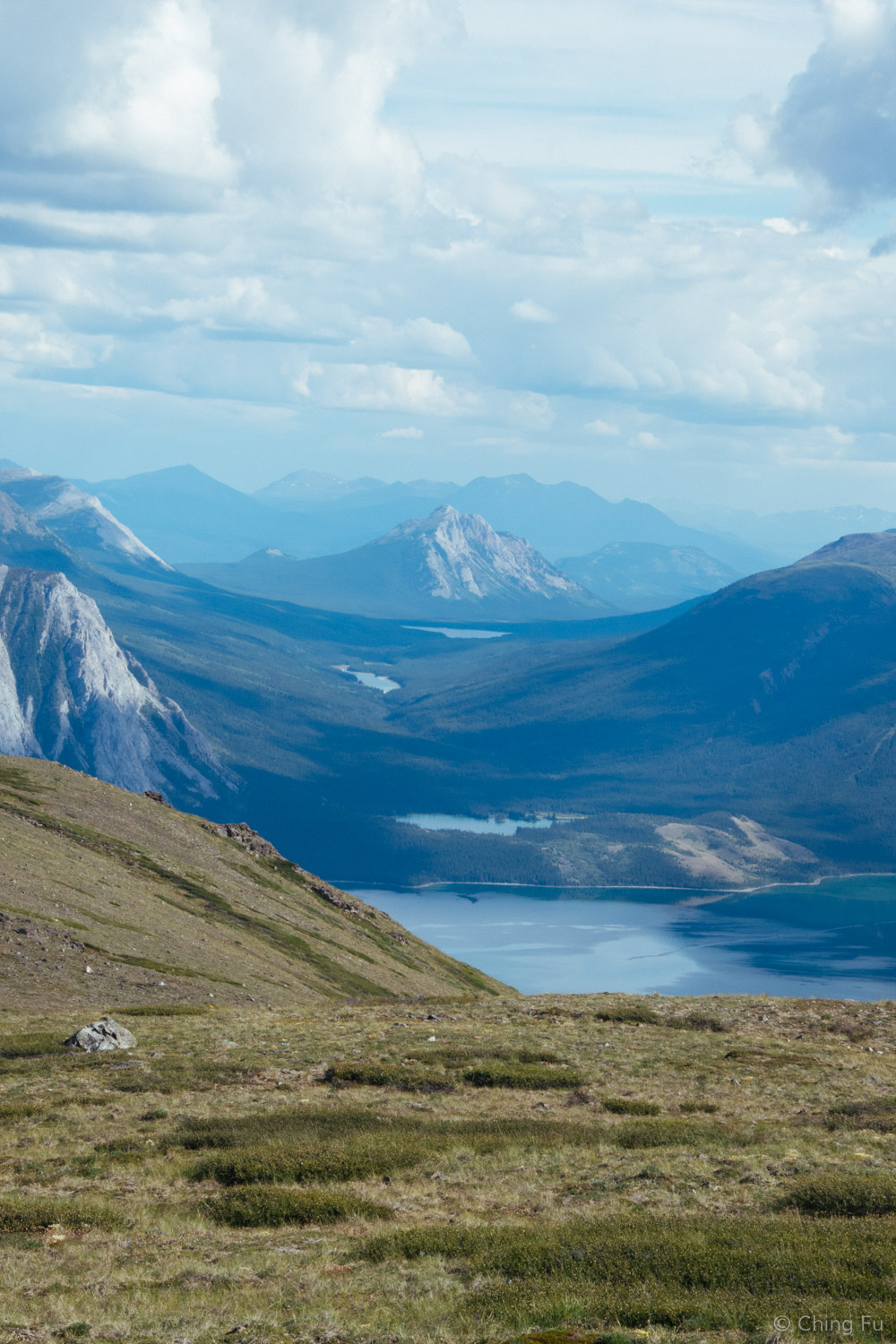
The hike to the top (not to the actual peak) is 5 miles roundtrip with 3,281 ft. elevation gain. Caribou Mountain is also the mountain range right in front of Emerald Lake. At the end of this hike, we could’ve continued walking to the top of the ridge in front of Emerald Lake. The trail up Caribou Mountain is a well-worn-in footpath that ascends one of the flanks of the mountain. The entire trail is in the open, providing clear views of Spirit Lake, Emerald Lake and the main view hikers are climbing for – the impressively large Bennett Lake.

Spirit Lake is the larger lake and Emerald Lake, where we camped, is the smaller one.

Bennett Lake
The treeless terrain also lets you see exactly where the trail goes, which is a non-stop uphill. From our vantage point it seemed to lead directly into the sky.

Look up and you'll find the trail.
Somehow we managed to confuse ourselves about where trail topped out. We figured, for reasons we still can’t explain to ourselves, the trail was going to bring us up the nasty looking peak that was made up of nothing but loose rocks. So when the trail faded about ¾ of the way up, we decided to head across the face of the mountain we were on.
We thought the trail ended on the peak to the right rather than the one in front of us.
As we walked across a field of loose scree at a sharp angle, I started to worry what a “difficult” rated trail was like if this one was rated “moderate”.

Not the trail.
Eventually we reached a saddle and decided that there was no way the hike went up the nasty peak. It was doable, but it would have really sucked. We eventually realized that we were dumbasses because the actual the trail continued straight up to the top of the knob that we were headed for during the entirety of our hike. The large wooden stick jammed into the ground decreeing it a conquered peak confirmed our assumption.

Views of Mountain Forget-Me-Not along the way.
The bright side to our mistake was that we got to see 6 Dall sheep nimbly run across the scree field below us and we got to walk through this really cool saddle that led us to views of the valley on the other side.
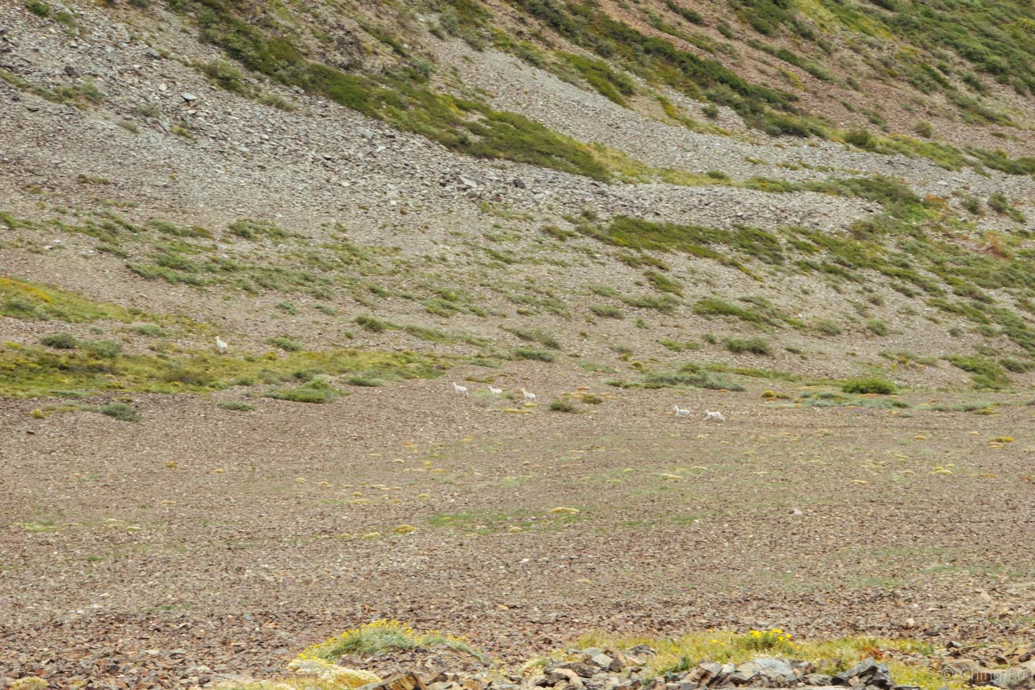
Dall sheep!
Finally, a flat spot!
Jerud and I prefer steep ups rather than steep downs. Unfortunately Caribou Mountain is an out and back so going back down the trail was terrible. The trail was covered with small loose rocks and a mix of dirt and dust that was fine for climbing up but unstable going down it. I’m pretty sure it was that downhill that ruined my legs. It took two days for our legs to recover from this hike.

This is actually a good section of trail because there are enough rocks to create some traction.
Nares Mountain
Nares Mountain trailhead is located less than 10 miles from Caribou Mountain trailhead in Choutla Subdivision. The trail is similar to Caribou Mountain – steep and straight up (with a few actual switchbacks): 4.8 miles roundtrip with 3,294 ft. of elevation gain.

Google Earth view of our hike from Yukon Hiking.
It’s also a worn in trail, with one or two spots where it dies out in the middle and again as you get closer to the top. Don’t worry if you lose the trail at any point; just keep walking straight up towards the highest ridge.

We had long-range views of Nares Lake, Bennett Lake, the town of Carcross, Carcross Desert and the mountain ranges in the distance.
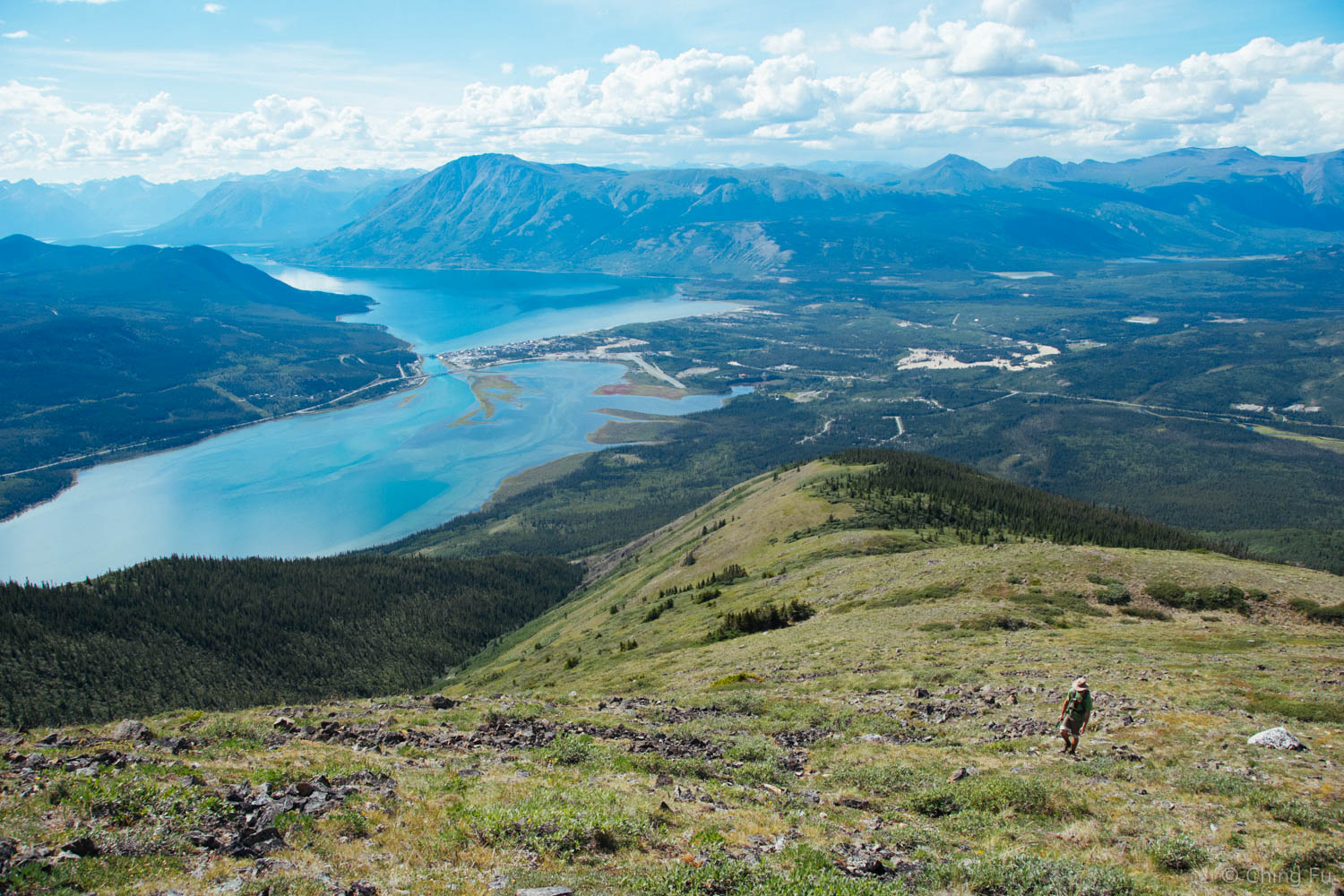
Nares Lake is in the foreground, Bennett Lake is in the background, and the small patch of brown towards the right of the photo is Carcross Desert.
One of my favorite wildflowers here - Northern Monkshood.
Prickly Saxifage
I had forgotten the trail description said there would be a 360-degree view at the top of the hike and was awe-struck when we got to the top plateau. From there we could see what was on the other side of the mountain: Tagish Lake, Windy Arm, and Lime Mountain along with additional lakes up the valley further in the horizon. We could also see Caribou Mountain.
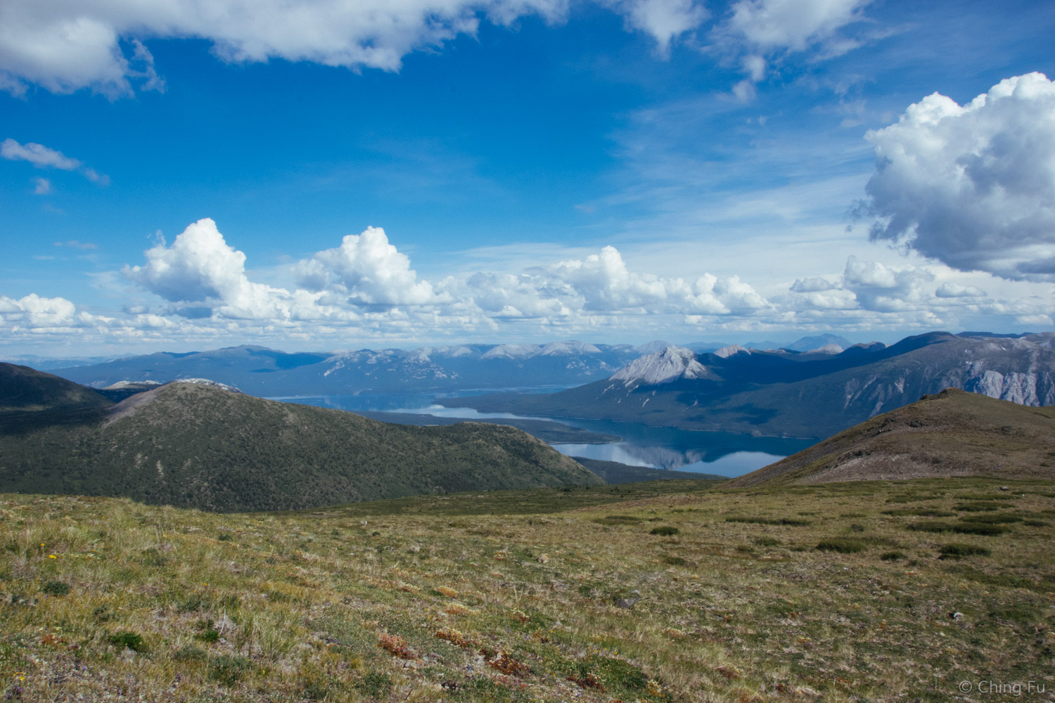
Tagish Lake and Lime Mountain
There are two ways up Nares Mountain. We followed Yukon Hiking’s direction and stayed on the left ridge to the top rather than the right ridge (you have to choose one in the beginning and stick to it until the end because you can’t cross over at any point). If we had more time, we could have hiked across the top plateau and come back down the right ridge to make it into a loop trail.
The further away ridge is the other way of coming up to Nares Mountain.
I found hiking back down Nares Mountain to be harder than descending Caribou Mountain. While both trails were steep, Nares Mountain trail had even less traction on it than Caribou Mountain because of the thinner layer of sand and loose rocks.

TIPS:
- Yukon Hiking is a great website with tons of hiking information.
- Read the comment section in Yukon Hiking because it will give you additional useful information and up-to-date trail status.
- Yukon Hiking's "difficult" rated trails tend to include scrambling and your own route finding at some point.
- If you only have time to hike either Caribou Mountain or Nares Mountain, I would highly recommend Nares Mountain.
- The trails on Caribou and Nares Mountains are both in the open, making it a very hot hike if the sun is out. Bring lots of water and wear sunscreen.
- Bring layers because the temperature drops a lot at the top of the mountain, including a raincoat because the weather can change quickly in this area.
- Drop by the Carcross Visitor Center to get handouts with hiking information.
We were in Carcross from July 4 – July 16, 2016.