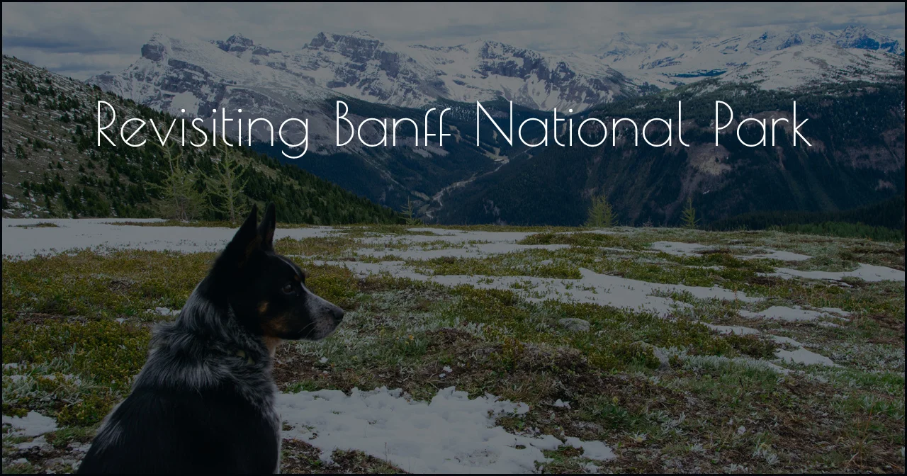
Mountain Bike & Hike Jasper National Park
Jerud and I didn’t make it past the Columbia Icefield on the Icefield Parkway the last time we were in the area. So we were eager to see the rest of the Icefield Parkway and spend a couple of days in Jasper National Park.
Wilcox Pass
Having already hiked the Toe of Athabasca Glacier trail before, we opted to do a different hike this time. But if you haven’t already hiked that trail, I would encourage you to. It was a very memorable hike and if we had more time, I wanted to do it again.

The thing that I remember the most is that along the hike there were wooden signs with years on them indicating where the glacier was back in those years. You can visually see how much it has receded over time. Global warming isn’t a joke.

We dropped the Toaster off at the Icefield Centre where there is an RV parking lot and you can stay overnight there for CAD $15 (or maybe it was CAD $17). There are limited parking spots and space at the Wilcox Pass trailhead. The Wilcox Pass campground is further down the road from the trailhead, but its spots are only big enough for 25’ long rigs.
Jerud and I couldn’t remember exactly if we had done the Wilcox Pass hike or not. But once we pulled up to the trailhead we realized that we had and that we had car camped at the Wilcox Pass campground.
Our hike to Wilcox Pass back in 2010.
Despite our intent to only do new hikes on this trip, Wilcox Pass is one that is worth repeating.
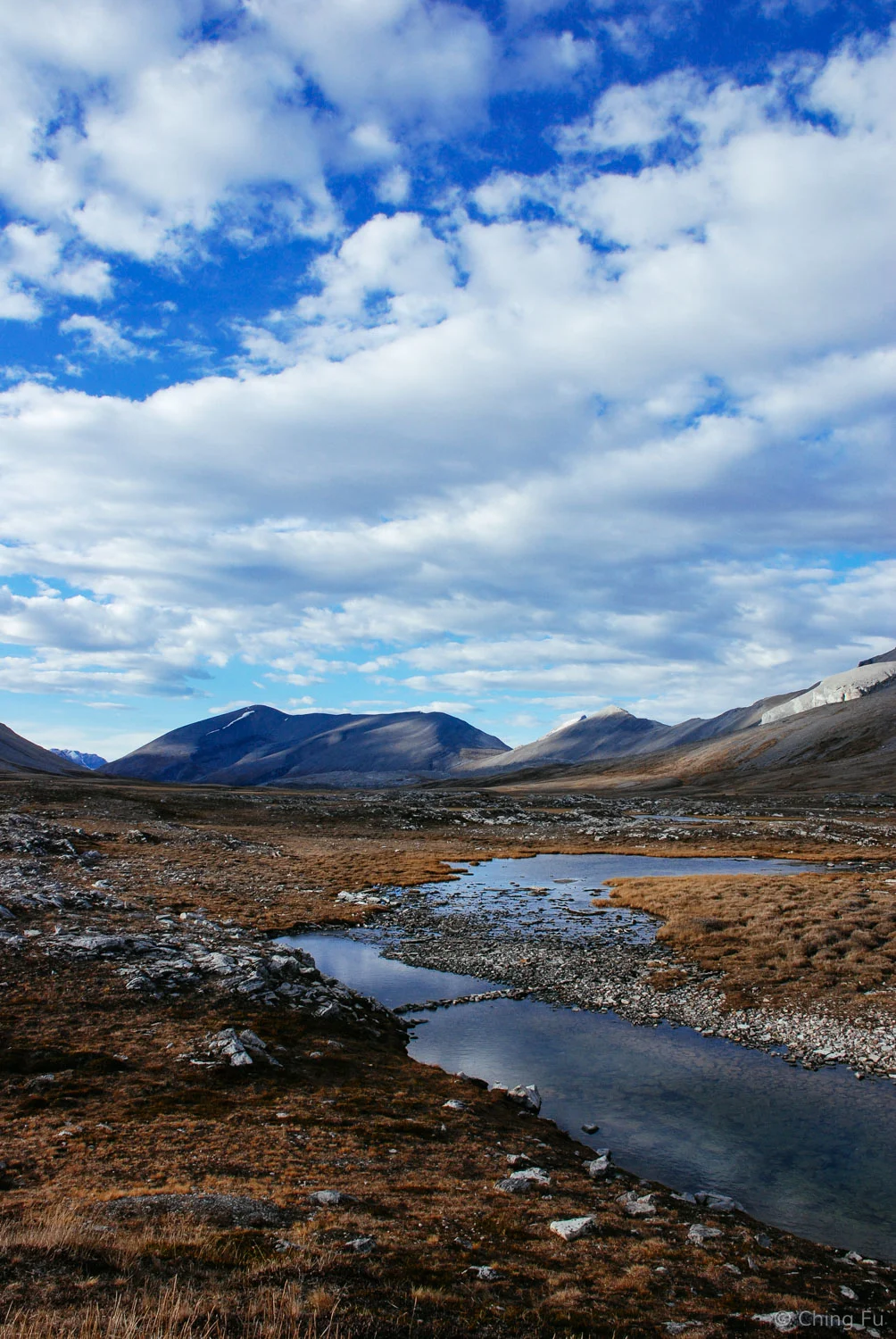
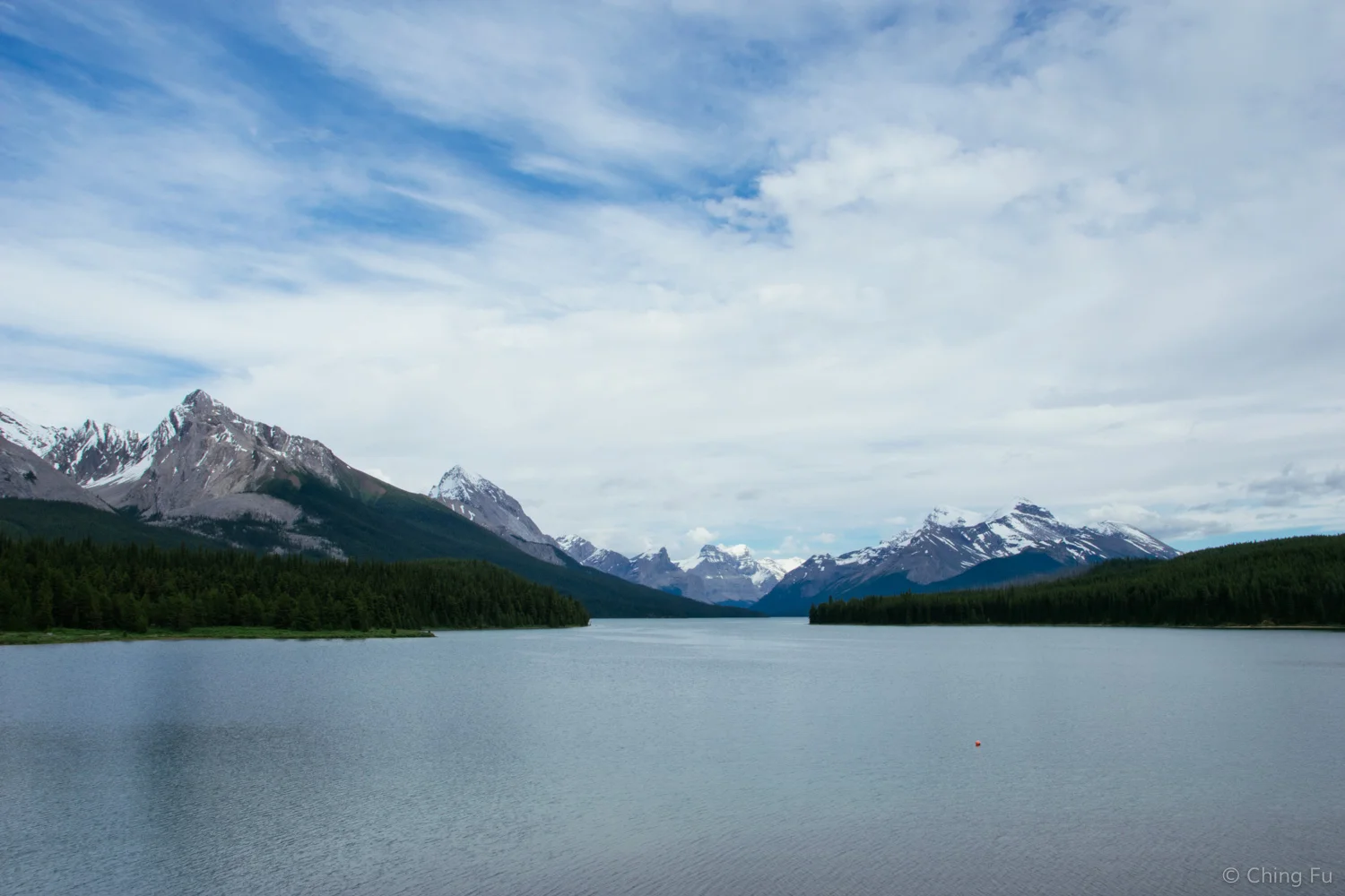
The hike brings you above treeline to an open meadow with expansive views of the Columbia Icefield. The landscape is glacier-carved and very dramatic. I was surprised by the handful of hikers on the trail. We only had to share the land with bighorn sheep last time.
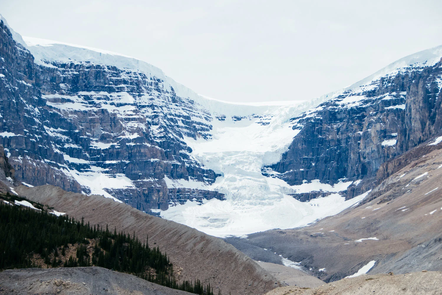
Field of the Columbia Icefield seen from Wilcox Pass trail on this trip.
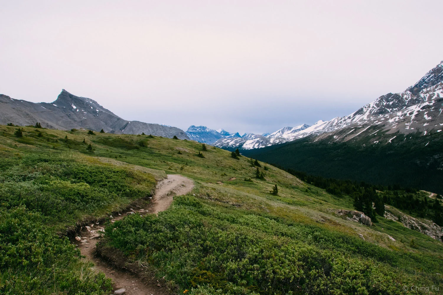
Wilcox Pass trail
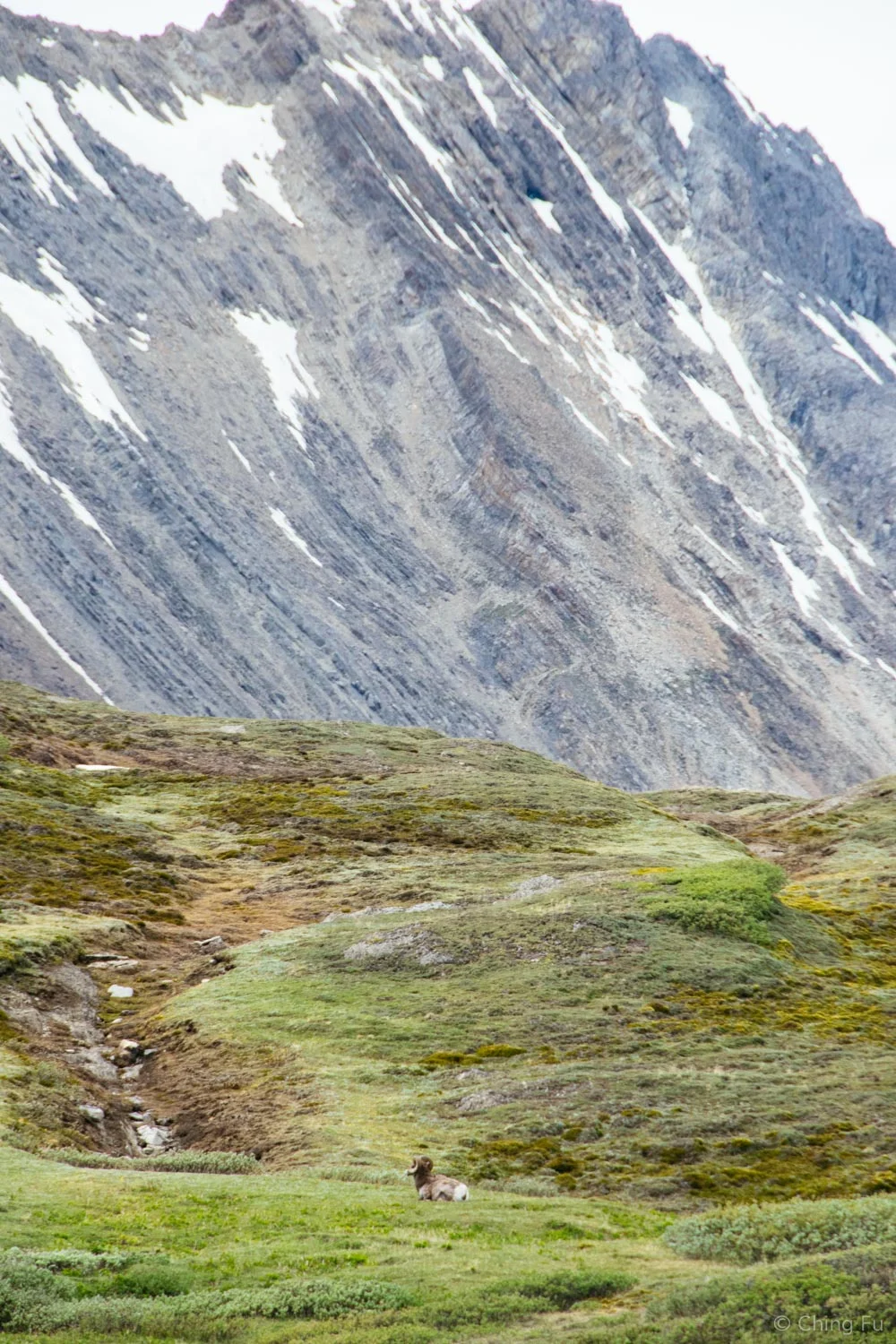
Bighorn sheep from afar.
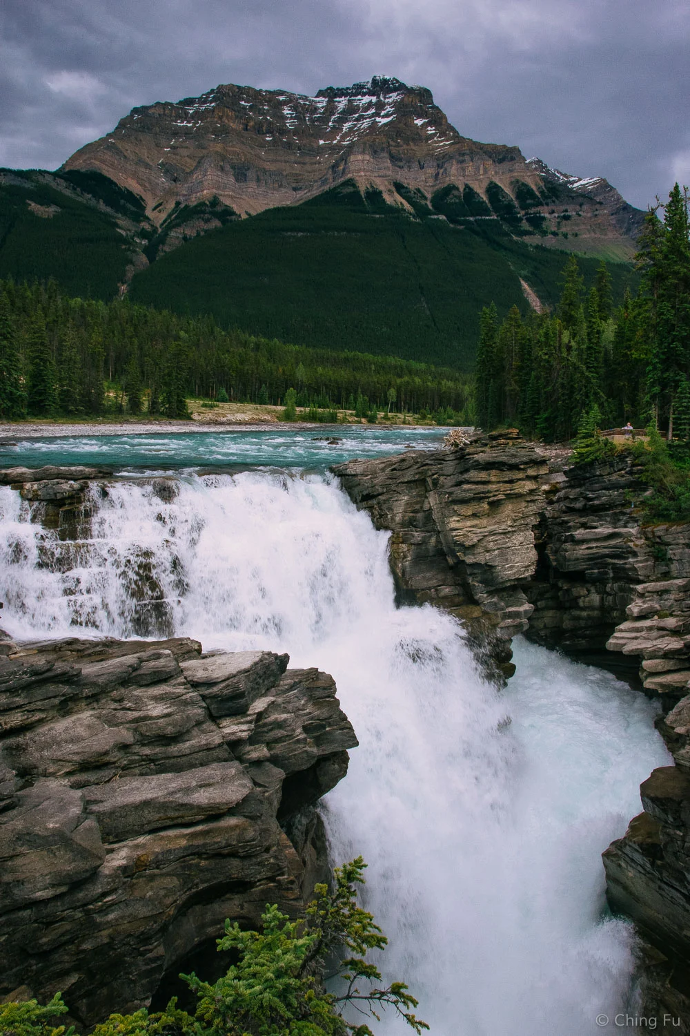
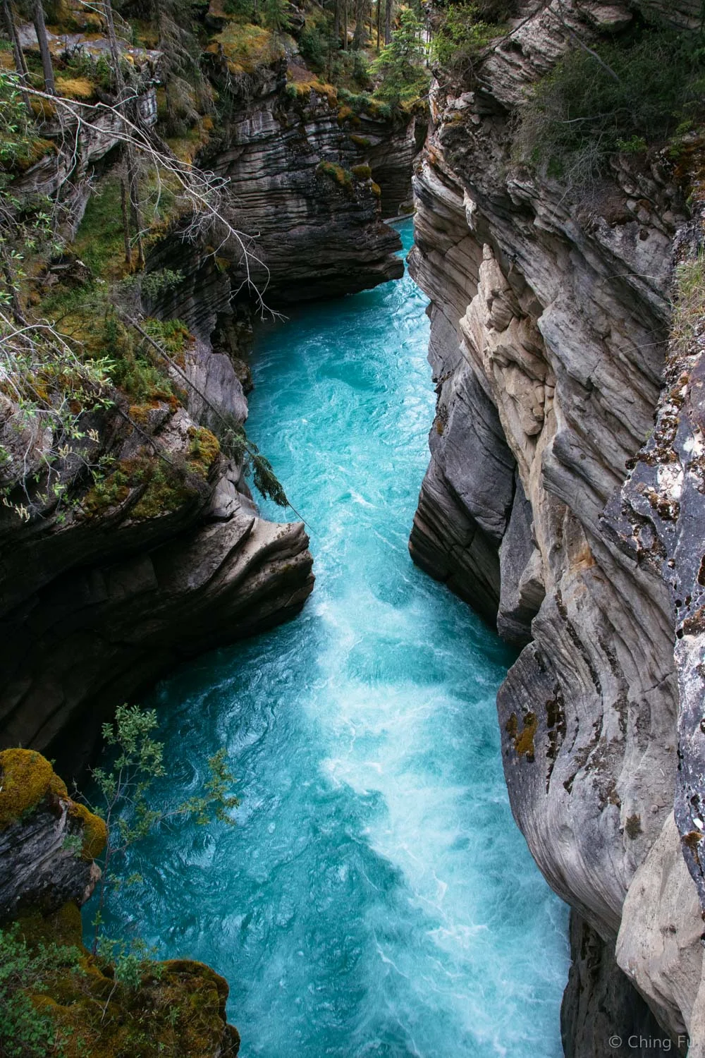
Athabasca Falls
It’s a short walk from the parking lot to the first viewing point where Athabasca River turns into Athabasca Falls. I always find it to be a special experience to see a waterfall from above or be at eyelevel with the top of it. Even on a cloudy late afternoon, the color of the water was mesmerizing.
The section of Athabasca River after the waterfall.
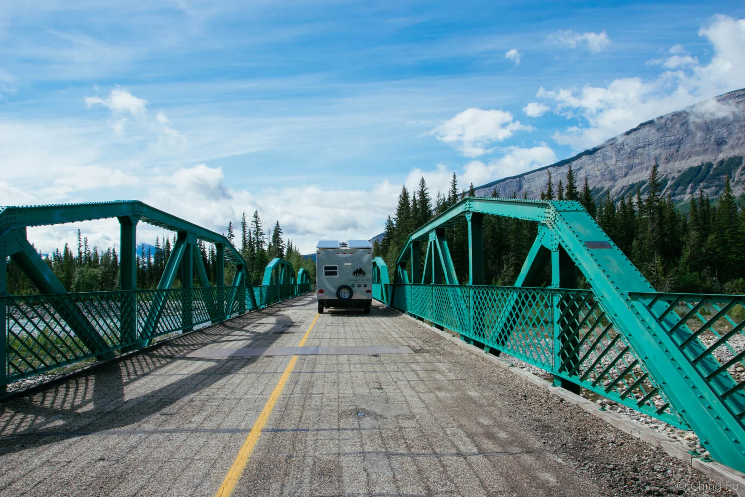
Snaring Overflow Campground
Snaring overflow campground is located about 15 km northeast of the town of Jasper. While it’s a bit further away than campgrounds like Whistlers and Wapiti, it’s also cheaper at CAD $15.60/night. It turned out that Snaring overflow campground was exactly what we were looking for (except that it wasn’t free) – it was a huge grass field opened to boondockers and car campers. There were dumpsters and pit toilets and that was it. We were excited to save a few dollars and we find it nicer to stay in an open field rather than a closed in campground (also better for our solar panels). I feel the same way about paying for campgrounds as I do about hotels – why spend money on them when I don’t hang out in them during the daytime and are I’m only there when my eyes are shut. I can sleep anywhere, so it might as well be free.
I love the color of this bridge that goes over Snaring River.
Snaring overflow campground is only open when there is a need for it. The downside to this campground is that they come and lock the gates everyday at 11 AM. So you have to be out by then. You also can’t pay for multiple nights and leave your RV there during the day. But the regular Snaring campground is a stone’s throw away from the overflow campground. The price is the same as the overflow lot, and at the Snaring campground you get the regular campground amenities: fire pit, wood, toilets, water and dumpster.

Snaring River
Town of Jasper
The town of Jasper has one lot that is specifically for RV parking and that’s where the Toaster spent the majority of its time. Aside from the one night at Snaring overflow campground, we didn’t stay at a campground the rest of our time in Jasper (two days/three nights). Instead we slept in one of the several pullouts along Hwy 16 and would leave the Toaster parked in the RV parking lot during the day. We asked a police officer about those pullouts and he said that they are technically for truckers who need a break during their long drives, but if a motorist needed it that’s fine too. Obviously we weren’t using the pullouts for what they were intended for, but we were able to get away with doing this for two nights. I think anymore than that would have been an issue. We did make sure that we left plenty of space in the pullout for a trucker to pull into.
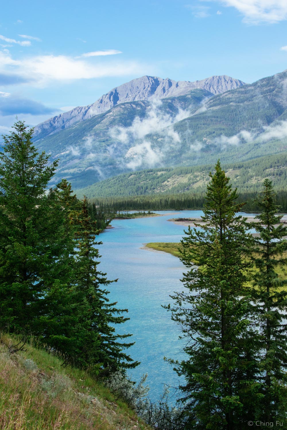
This is the view of the Athabasca River from one of the pullouts, although not the one we stayed at.
Unlike Banff, Jasper is a lot calmer and quieter. Jasper is further away from any big towns. It's 227 miles from Jasper to Edmonton, the nearest large city vs. 68 miles from Banff to Calgary, its nearest large city. There weren’t as many tourists and RVs around Jasper, even over the weekend. Jasper also a lot smaller with fewer retail stores and restaurants. While we were there, the RV parking lot always had empty spots available.
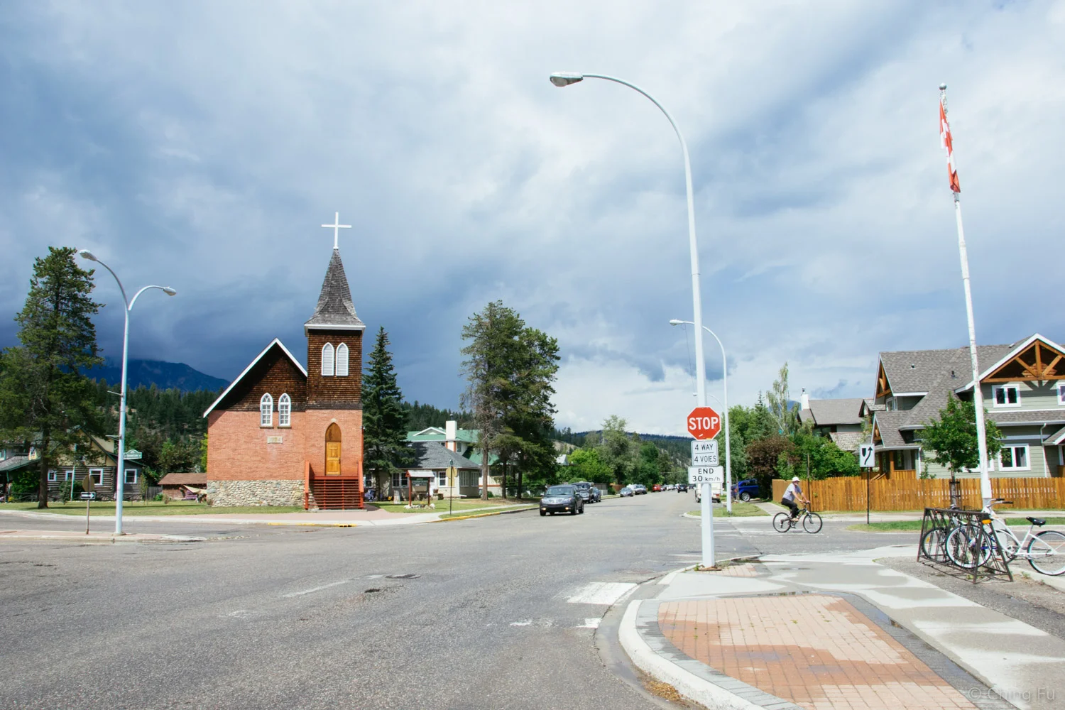
The neighborhood right behind downtown Jasper.
It rained for the majority of the first day we were in Jasper. We ended up not going for a hike or bike ride and opted to hang out in town and do some sightseeing. At Bear’s Paw Bakery we met a German couple that has been living in Canada the past five years. It turned out they live on Cape Breton Island, Nova Scotia. The name meant nothing to me aside from the fact that I want to visit Nova Scotia, but it caught Jerud’s attention. He had recently come across this website that was supposed to be a tongue-in-cheek site saying that American political refugees were welcomed there if Trump became president. As you can probably imagine, the site got really popular and Cape Breton’s tourism numbers have increased because of it. Anyways, we had a great conversation with this couple.
Double Rainbows
Thanks to the rain we kept getting during our stay in Jasper and time in Canada in general, I have seen more double rainbows than I ever have!

Patricia Lake
During the next set of rainstorms we hid out in Jasper Brewing Company. Good beers, bad poutine.
Tired of sitting around, we decided to drive out to Patricia and Pyramid Lakes where the sky looked clear, for the time being. There are a bunch of mountain biking trails in that area that our friend Mary, who was there about a month before us, recommended. The trails were too wet for riding but the dogs got to play in Patricia Lake while we took in the views.

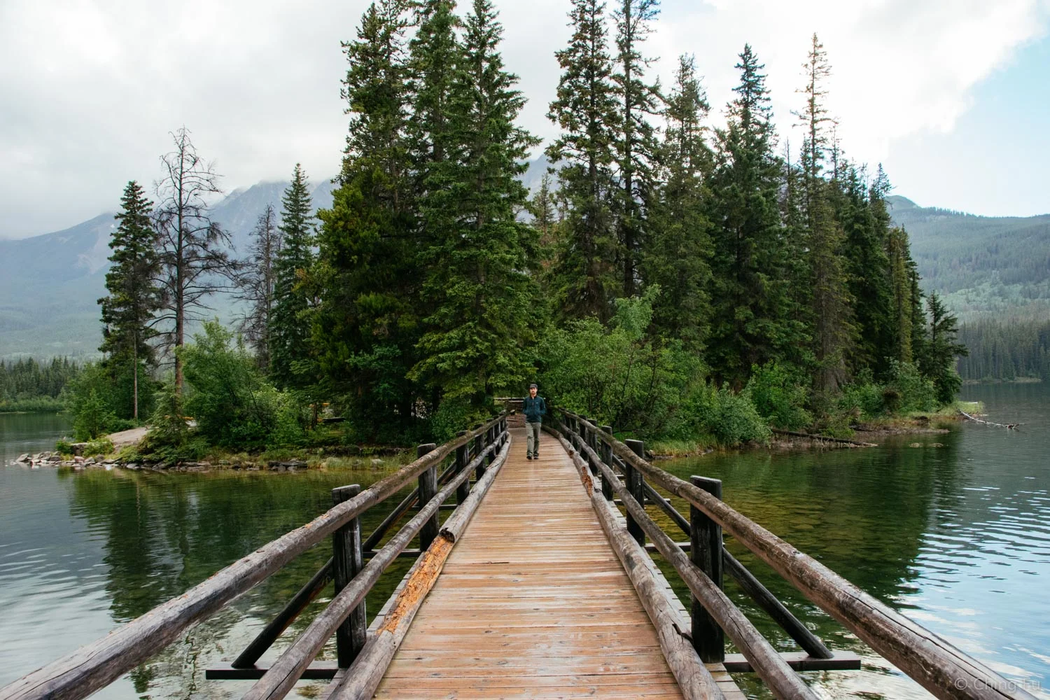
Pyramid Lake and Pyramid Island
We drove down the road just a bit further to get to Pyramid Lake. There’s actually an island out in the lake that we could walk to via a bridge. We grabbed our jackets and checked it out as it started to sprinkle again. It’s a really neat island with a picnic shelter and benches scattered around.
Valley of Five Lakes Loop
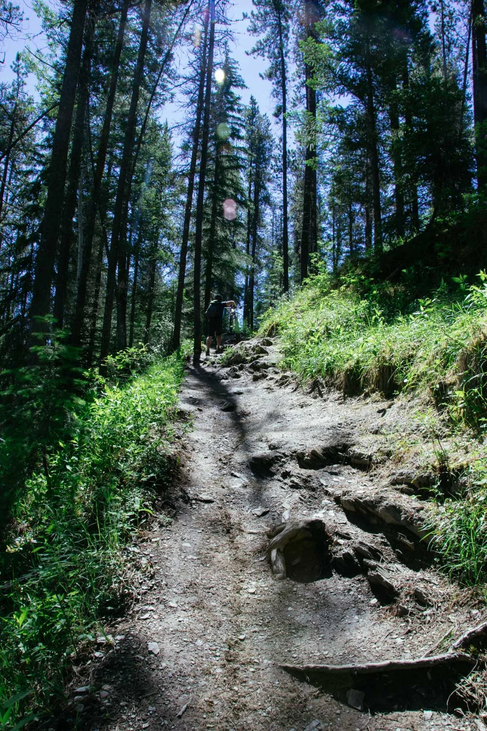
This was the highlight of our time in Jasper. When we asked the shop guy at Vicious Cycles about trails, Valley of Five Lakes was his first choice. I was totally sold that we would be able to see five lakes on one ride! It turned out this wasn’t only a wonderful sightseeing ride with great views, but it was a damn good 15-mile mountain bike ride.
The ride started with walking up the stairs to Old Fort Point.
But you get a great view of Athabasca River after climbing up the stairs.
Despite the trails not being specifically built for mountain biking, it was so much fun – more fun than I’ve had riding in awhile. There were good climbs - a mix of technical sections that required picking a line through scattered rocks and short steep sections. The downhills were fast, tight and curvy. Then there were the straight up rock and root gardens, threatening to stop the bike short if we didn’t pedal just right.
Short but steep hike-a-bike section.

Riding in and out of the trees.
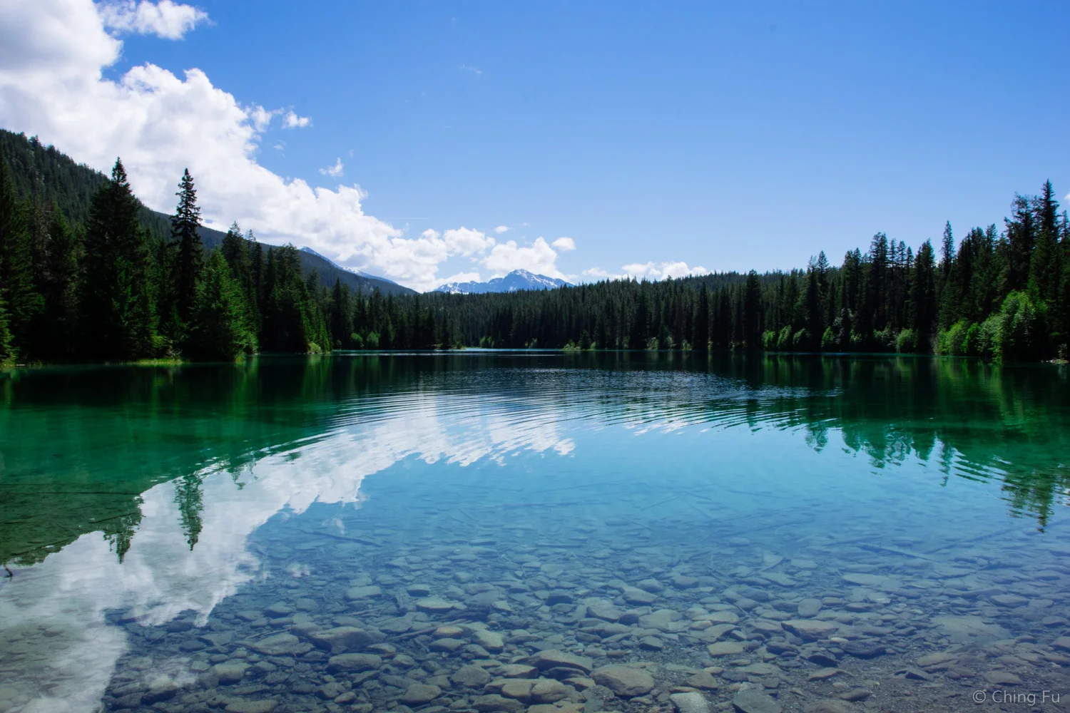
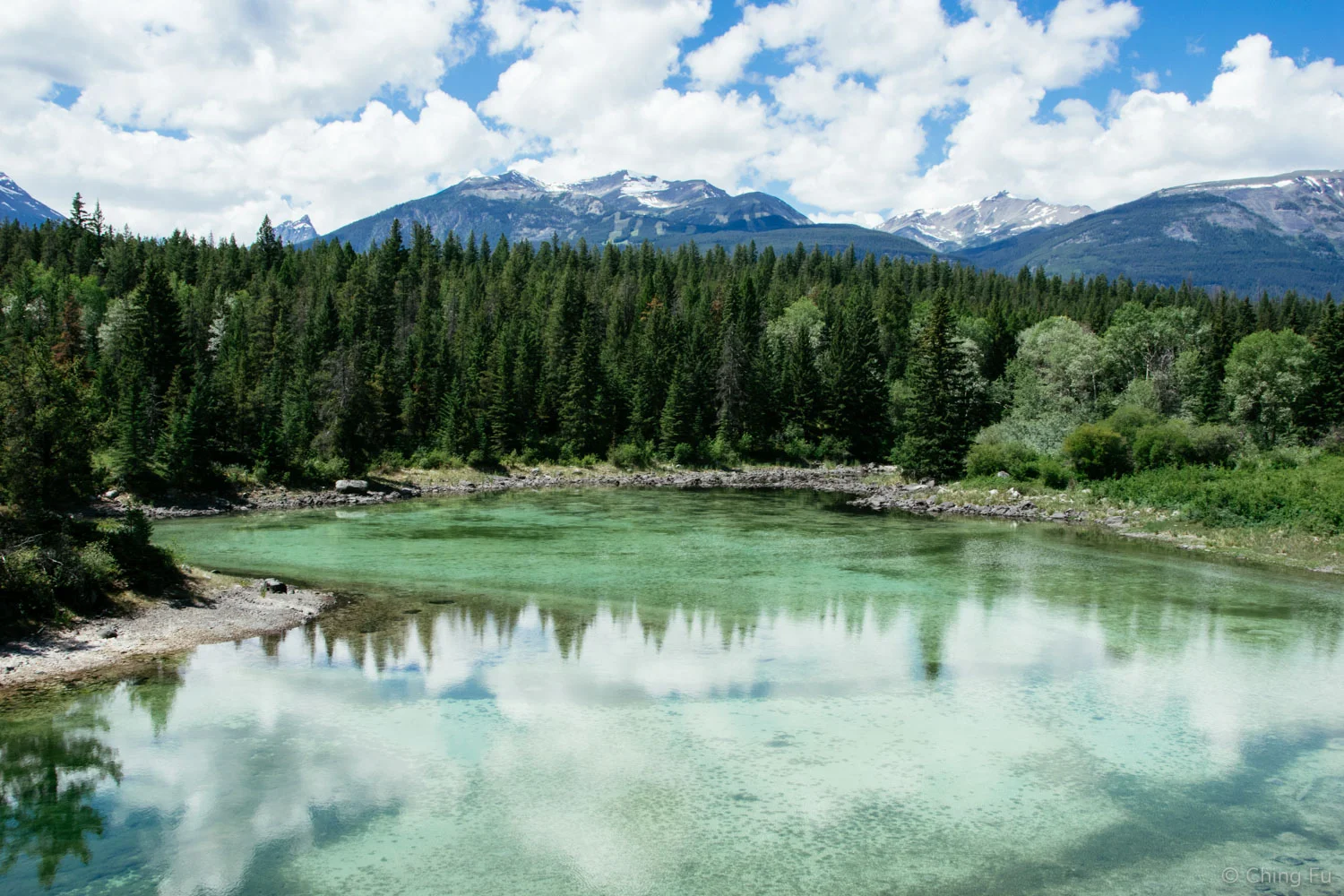
Coming to First Lake was so exciting with its brilliant blue shimmering through the trees. Beckoning us to get closer, which we did. And there were 4 more similar to this one, varying in size and color because of their different depths.
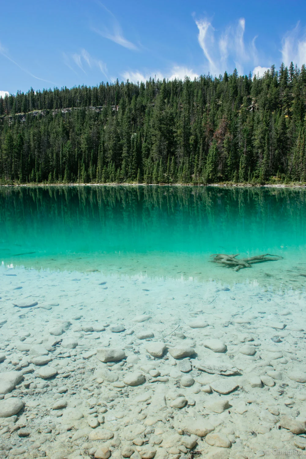
First Lake
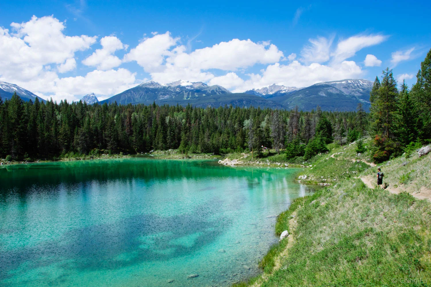
Second Lake
There’s a short section on trail 9A that goes between lake #4 and #5 that the map and shop guy both recommended not bringing bikes on. The main reason is that it can get crowded with hikers there. So we stashed our bikes under a tree off trail 9B and hiked to Third, Fourth and Fifth Lakes. It turned out not to be crowded and aside from one hike-a-bike section, the trail looked fun to ride. I wish we had brought the bikes with us and just gotten off if necessary.
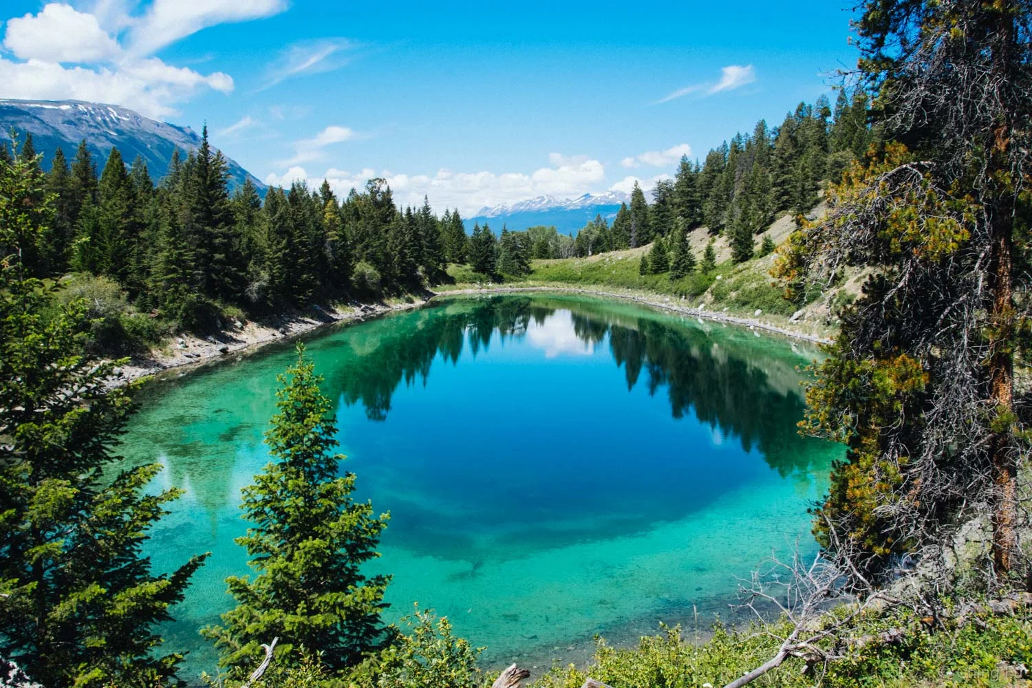
Third Lake
We rode back on some of the same trails, creating a dumbbell loop. The other option is to ride back on the Icefield Parkway if you’ve had enough of the climbs on the single track (which there are a lot of).
Fourth Lake
Obviously there’s a way shorter hike that can be done to visit all five lakes. I wouldn’t recommend our bike route for hiking because a good chunk of it wouldn’t be as interesting done on foot as on wheels.
Fifth Lake
This ride was super neat because instead of driving to the trailhead of the start of the hike around the lakes, we rode on singletrack from where the Toaster was parked in town to the start of our mountain bike ride and then continued on singletrack to get to the lakes! If I had to choose between hiking and biking to see a sight, I will always choose biking. The speed of a bike is more enticing to me.
The route and direction we took per Vicious Cycle's suggestion.
Maligne Canyon
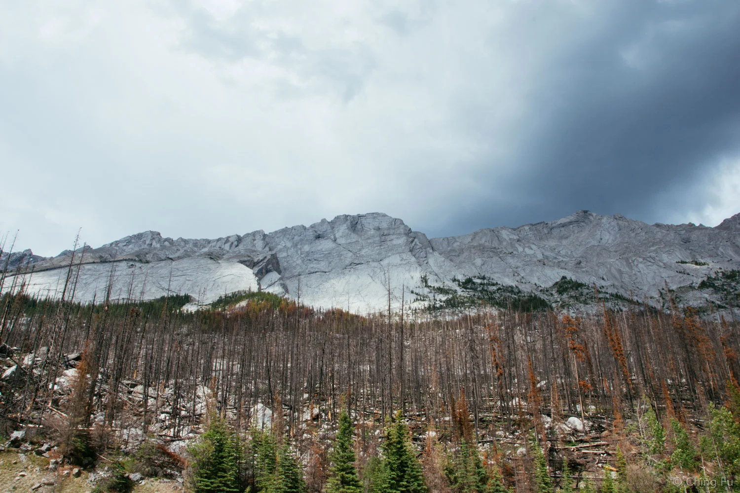
After our ride we brought the dogs to check out another part of Jasper National Park, Maligne Canyon. The drive into Maligne Canyon brings you alongside the formidable and intense looking Colin Mountain range. At the foot of the mountains stood the remains of a very recent wild forest fire (June 2015) that brought this interesting stark yet colorful contrast to the landscape.
We briefly stopped at Medicine Lake and then continued onto Maligne Lake where we did a short hike on Mary Schäffer Loop trail passing the historic Curly Phillip’s boathouse.

Medicine Lake
Maligne Lake
On our way back out of the canyon we came across a mama bear with her two cubs. From inside the truck, I "ooed" and "ahhed" over their cuteness. Note that I said “from inside the truck”, unlike all these idiots we’ve seen in other situations that get out of their car to get closer to the wildlife to get selfies with them. I don’t care if those people die from their stupidity, but their selfish actions can cause the wildlife to be moved from their current habitat to s far away locations or even worse killed. Go be stupid in your own backyard.


The cub was testing out her legs. She awkwardly walked a short bit before falling over. Ugh, so cute!
Tips
- If you’re coming from Banff to Jasper, know that Lake Louise visitor center has very limited information and maps about Jasper National Park.
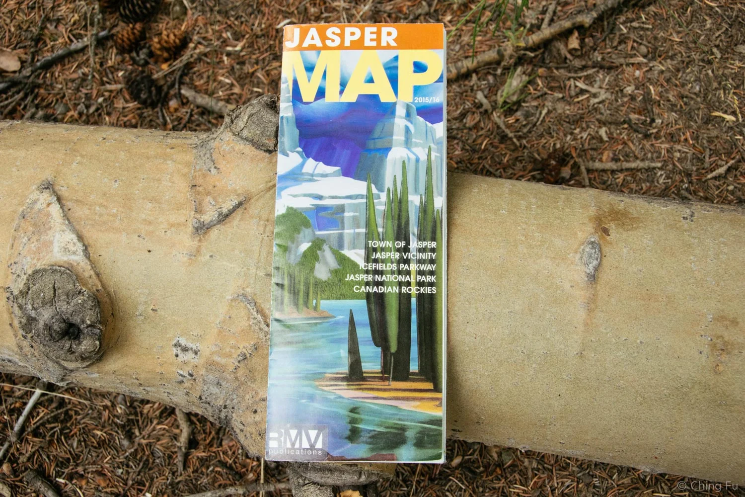
- Look for the Jasper Map by BMV publications. It’s a pretty good map for being free.
- Like Banff, the town of Jasper is located inside the national park so you need a park pass to even be in town.
- As I mentioned in my Banff post, if you buy daily park passes, keep the receipts for them because that cost can be used towards an annual park pass if you decide you want to upgrade.
- Canada is offering free entry to all their national parks in 2017.
- Canadian national parks allow dogs as long as they are leashed. There may be certain trails they are not allowed. From looking at the Jasper map, there are more trails that dogs are not allowed on than in Banff. Make sure you know what those trails are.
- Check out the Edith Cavell area of Jasper if you want views of glaciers. We didn’t get to but I really wish we did.
- Be sure to stop at Lower Sunwapta Falls along the Icefield Parkway (it’s before Athabasca Falls coming from Banff). We didn’t know to stop there until after we got a map at the Jasper visitor center, but Lower Sunwapta Falls is made up of three major waterfalls.
- Similar to Banff National Park, you can get a good PDF Jasper mountain biking trail map online.
- WiFi at the Jasper visitor center sucks. But Jasper Brewing Company has good WiFi (and a decent IPA). The town library was closed for renovations while we were there.
We visited Jasper National Park June 18 – 21, 2016.
Thank you for making your Amazon purchases through our affiliate link.
Related Posts