Five Finger Rapids & Midnight Dome In Yukon
The drive from Whitehorse to Tombstone Territorial Park (our next stop) is far, like 400 miles far. That’s too much mileage for us to make it in one go, especially knowing the Dempster Highway (which brings you to Tombstone) is especially slow going in an RV.
Our plan was to take our time and make the drive over two days. So we stopped at Five Finger Rapids Recreation Site along North Klondike Hwy - any excuse to get out and stretch our legs and check out the scenery.

Stairs that lead down to Five Finger Rapids.
Early miners named this section of the Yukon River Five Finger Rapids because of the 5 channels, or fingers, formed by the rock pillars.

Walking to edge for a better view of Five Finger Rapids.
Originally the current here was very strong and during high water the rapids created a 1 - 2 foot drop. But during low water, boats could get through without any issue. Sternwheelers that were ascending the rapid had to winch themselves upstream using a cable that was attached to the rocks. This was a pain in the ass for them so the final solution was to get rid of the rapid. Blasting occurred from 1900 until around 1927 to remove the rock, which also widened the channel by 20 feet. The safest route was through the nearest passage in the photo above.

It's a 0.6 mile hike down to get a closer look at the rapid.


Large platform overlooking Yukon River and the rapids.
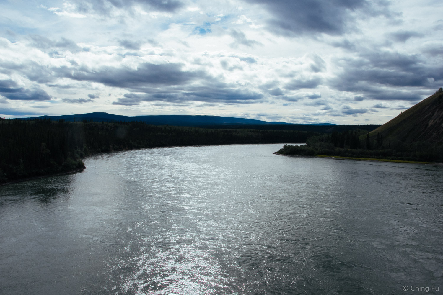
Yukon River

Overlook platform
We weren't going to stop in Dawson City, but by the time we got to the turn onto Dempster Highway from North Klondike Highway we were in need of gas (there's a gas station at that intersection but the prices are high!). Also, we decided it would be smart to stop by the visitor center to get some updates on the Dempster Highway conditions. It had been raining a lot and the Dempster Highway is made of gravel on top of permafrost - not a good combination.
It was a good thing we made the detour because the Dempster wasn't in great condition, and the weather forecast was calling for additional rain the next couple of days.
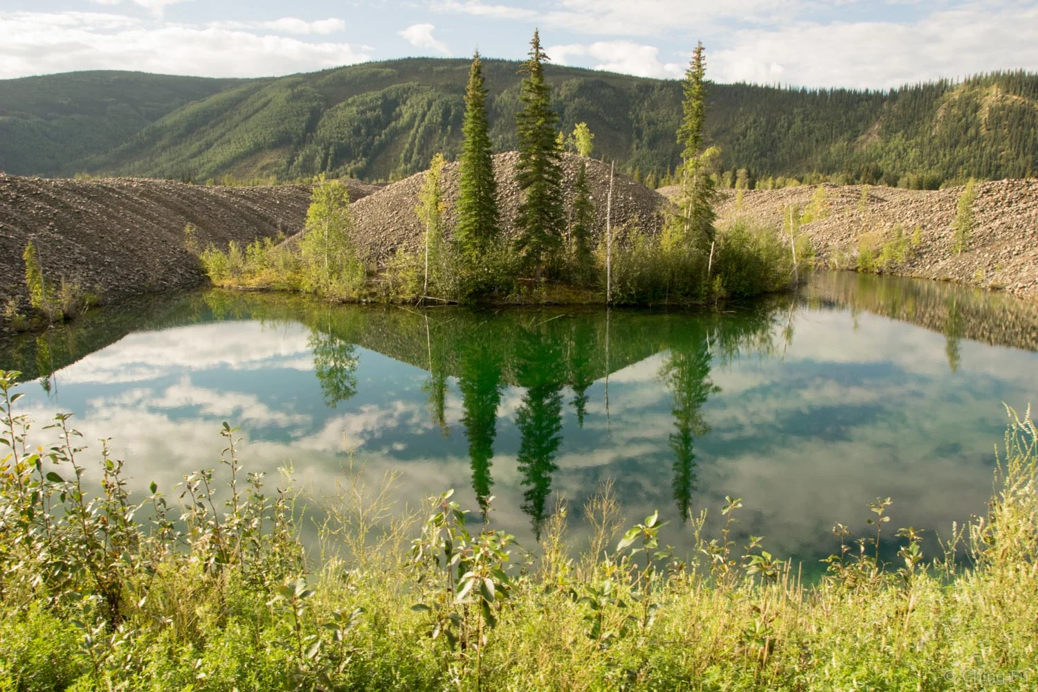
The discovery of gold in Klondike River made Dawson City boom, but also displaced the First Nation people as gold seekers took over the area. Dawson City was Yukon's original capital and in 1960 it was declared a historic site. Remnants of the gold rush are all over the town. The most obvious ones are immediately noticed as we drove into the town: the land on the side of the highway looked like a bulldozer had torn it apart and created piles after piles of rocks. This is essentially what happened because dredges dug the land up looking for gold.
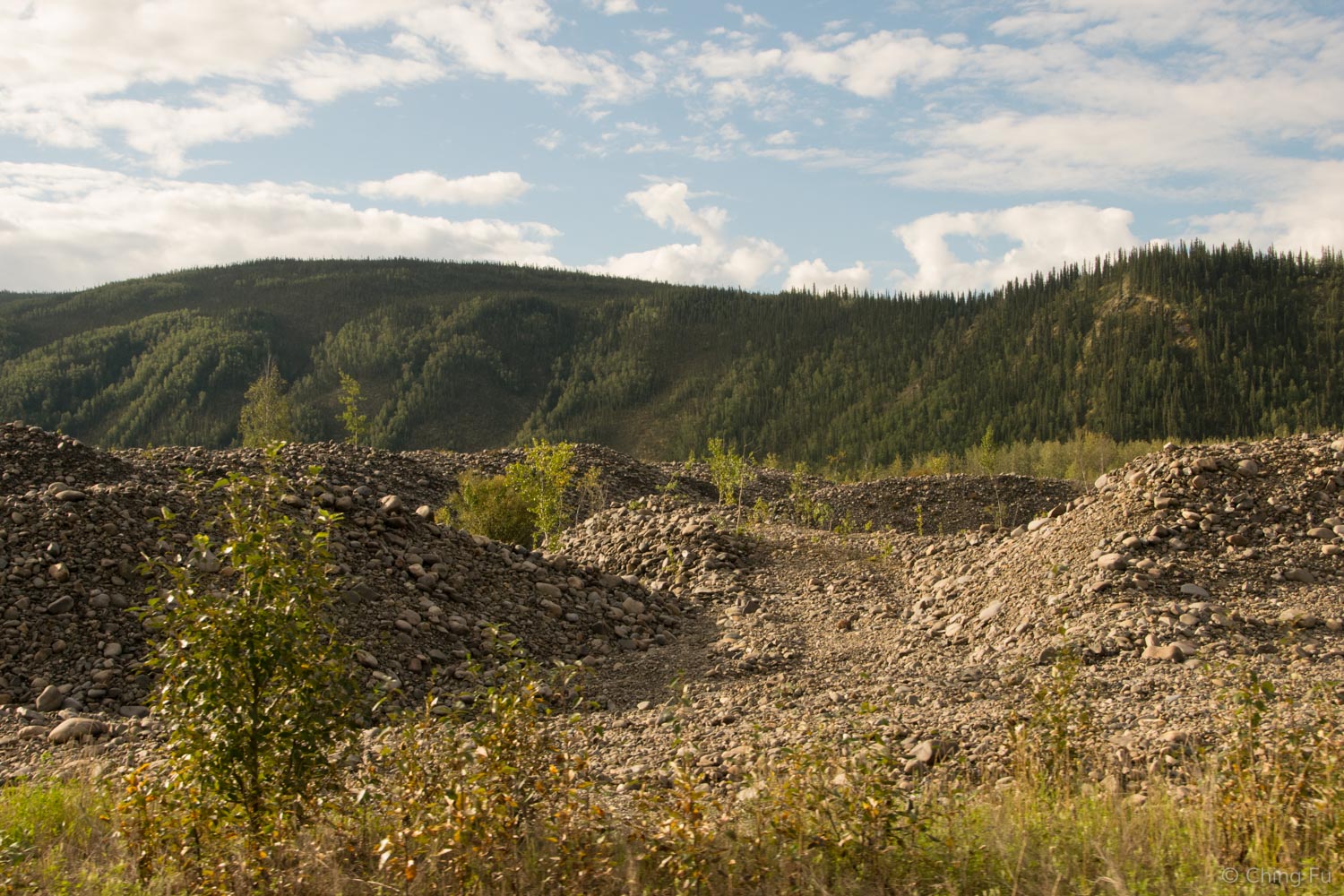
Gravel piles from gold dredging.
Dredges dig up gravel in the front, recover the gold in the gravel through a revolving screen washing plant, and then deposit the gravel out the stacker in the rear.

This is a model of drege number 4. In real life it's 2/3 the size of a football field and 8 stories high.
Left behind are ponds where the gravel was dug up with mountains of gravel surrounding it.
We ended up spending two nights in Dawson City boondocking for free at Midnight Dome (we found the spot through iOverlander). The site itself wasn't much of a looker.

We shared the large pullout with two unimogs and a SUV.

And we found some wild raspberry bushes.
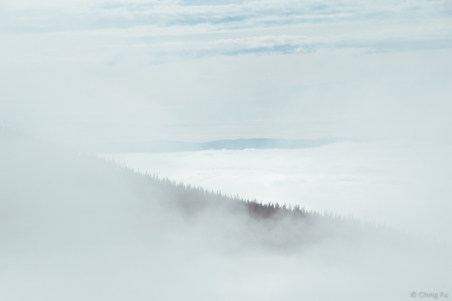
But the view from Midnight Dome was something else. No wonder it's a popular sightseeing spot.

Early morning fog.

Yukon River and the town of Dawson City below.

Midnight Dome is a knob of metamorphic rock. On June 21, 1899, 150 people came to this spot to see the midnight sun. Disappointingly, the sun set half an hour before midnight and rose two hours later.
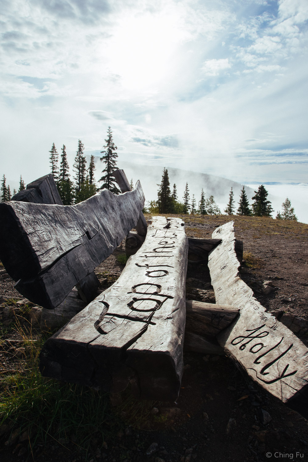
"Top of the World" bench at the top of Midnight Dome.

Sunset over the Yukon River.

By the time we got to Midnight Dome, the sun was already setting earlier. But we made multiple trips up to the dome in between the rainfall each day to take in the views.
We visited this area August 14 - 17, 2016